Ground Based LiDAR Mapping
The CartoSolution advanced mobile mapping algorithm incorporate Lidar with high resolution video to make very high resolution and accurate data model. The CartoSolution mobile Lidar data processing technique is optmized to process large data set within givn time period. CartoSolution mobile mapping data process services offer remarkable 3D detail from a vehicle moving at speeds up to 50mph.
LiDAR solutions
Surface Models and Point Clouds
Digital Elevation model is the most demanding data from aerial and mobile LiDAR data. These models normally in grid or TIN formats and generated by various software. Generated DEMs are used also for orthophoto generation of Drone images. These surface models are being utilized in various projects like environmental assessment and asset management. Our classified data produse lot of other data like automatic vectorization of utility, generating building facade and many more. The point clouds help you to detect and measure objects, which is very painful and labour intensive by conventional methods.
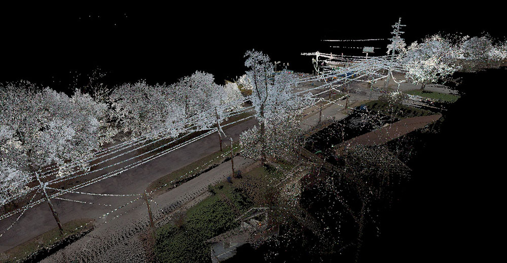
Highway Survey
CartoSolution process Mobile Lidar data for highways, infrastructure, and buildings data colected from vehicle-mounted lasers and video cameras. It is a tested method for genrating engineering grade Lidar data over large study areas where surveys are unworkable with static Lidar sensors and require an point density and resolution exceeding those available from drone. driving at normal speeds lemits, Sensors Captur every detail along a highway corridor including road barriers, ditches, and overhead power lines we can create 3D digital city models, road maintenance, and asset management applications such as:
- Road Infrastructure
- Overhead wires, light poles, road signs, etc.
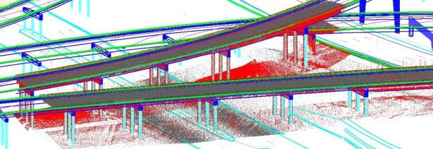
- Bridges and under pass
- Road surface conditions
Railway Track Management
Railway network need precise information from its own network. For expansion LiDAR mobile and airborne can play important role to plan new routes, to maintain existing infrastructure and asset management purposes. LiDAR is low maintenance remote data acquisition system, which allow surveyors to work safe in busy railway corridors without interrupting the schedule and minimize the track sections closedown this does not include mechanised maintenance of track sections. Our methods and process can reconcile with Track Management System (TMS).
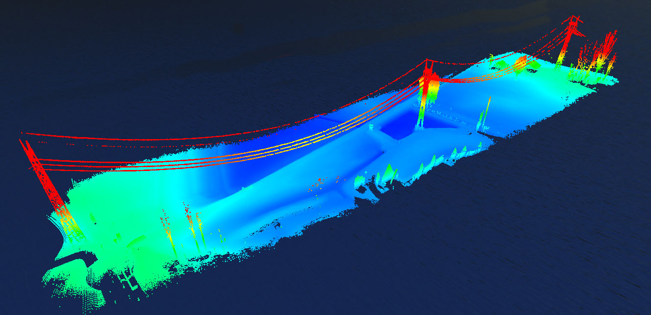
Powerline Mapping
For utility companies, active vegetation management cut down the cost and play vital role in un-interrupted supply by counter damage to power lines. The role of LiDAR is an impressive and could be the best system available to map wires and towers transmission and distribution lines. The mapped data allow you and your client to review the clash detection report of infrastructure and act accordingly. This allow your maintenance crew to work with pinpoint accuracy and cover lot more area in less time.
Our process include
- Minimizing noise from lidar
- point cloud classification
- Generation of DTM/DSM
- Feature extraction
- Registration of imagery with lidar
- RGB LiDAR
APPLICATIONS FOR Mobile born LIDAR:
- Utility Management
- Clash Detection
- Power Line Digitization
- Asset Management
- Road Condition
- Tunnel Monitoring
- Road-Feature Extraction
- Sight distance analysis surveys
- Coastal Erosion Mapping
- Corridor study and planning surveys
- Engineering topographic surveys
- Bridge clearance measurement
- Deformation surveys
- Earthwork surveys
- Construction inspection
- Crash prediction and response
- Architectural restoration
2D/3D POWER LINE NETWORK Mapping
The majestic alliance of LiDAR data and ground survey data permit us to provide next leval utility mapping services, while keeping the project cost well under control the costs of conventional electrical grid/distribution mapping, network maintenance and service calls.

LIDAR BASE SPECIFICATION
Maybe more than other remote sensing advancements, lidar gathering cloud points are exceedingly reliant on the earth of the studied area. Landscape, land use, vegetative spread, level of urbanization, and various extra factors can manage diverse flight envelopes, instrument settings, information thickness, swath overlap, and a lot more parameters from venture to extend. Despite the fact that these varieties must be acknowledged, this segment characterizes various accumulation prerequisites that must be met to accomplish the reliable lidar gathering.

Railway Coridoor
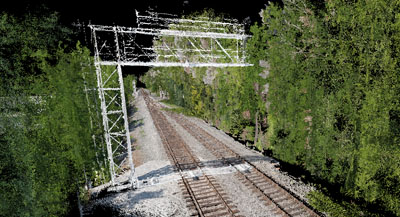
In Past old railway track survey techneque where used to measure diffrent elements of rail track, the electrick wire and the rail base on the opposing side was and is labor intensive, time consuming and data never deleiver on time. The LiDAR mobile mapping makes workflow faster, accurate and cost efective. In comparison to conventional survey approach, Lidar data procurement take less time, minimizing the interruption of rail movement, measurements are periodic, and are effortlessly select by the system engineer.
GIS-based fundamental
Performance of this system will allow a GIS-based fundamental technique for power line corridor vegetation control, location of the output risky object are interoperable with a different platform of software on static and mobile devices. This allow decision makers in related industries to cut the cost and time because of pinpoint data of hazardous vegetation that may need to remove.